ESA08 Oct 2026
Sentinel-3C returns its first views of Earth
Irish relevance: continuity for sea-surface temperature and ocean-colour data around Irish waters.
Free and open satellite data and services show change across Ireland’s climate, farms and forests, coasts and emergency events. Explore Irish examples, meet the national EO community and find the data, skills and opportunities to take your next step.
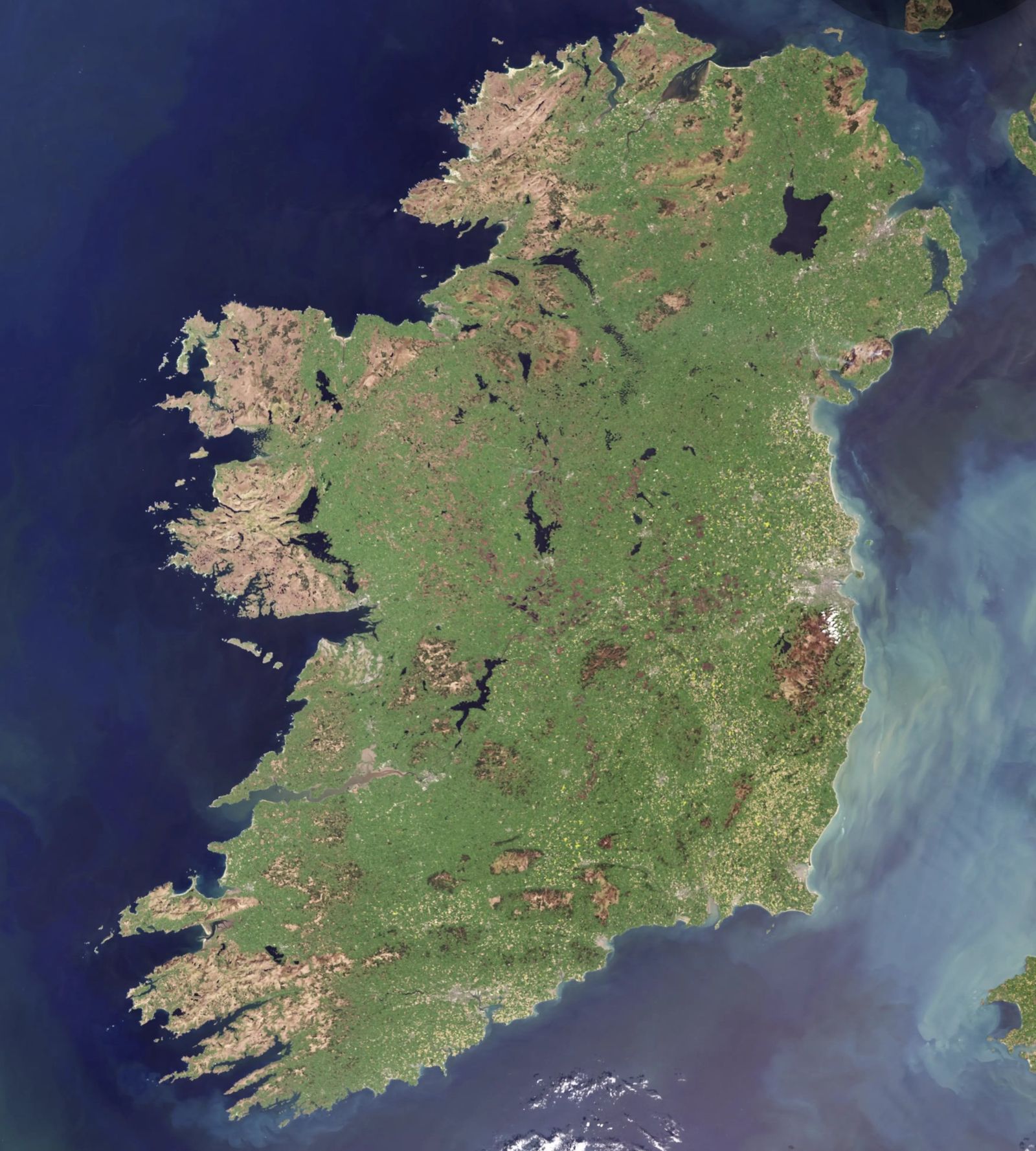
Earth Observation (EO) is gathering information about our planet from a distance, mostly from satellites, aircraft and drones. Sensors measure the light and energy reflected or emitted by land, water and air. Processed, those measurements become maps and indicators that people use to make decisions.
Optical sensors record reflected sunlight in visible and infrared bands. Radar (SAR) sends its own microwave pulse, so it sees through cloud and at night. That matters in Ireland.
Raw measurements are calibrated, corrected and combined into products: true-colour images, vegetation indices such as NDVI, flood extents, sea-surface temperature and climate records.
Agencies, companies and researchers use these products to check farm payments, forecast seas, track climate change and map floods while they are happening.
All-weather, day-and-night SAR. Floods, ploughing and mowing, ships, ground motion.
13 bands for crops, grassland, forests, burn scars and coastal change.
Sea-surface temperature, ocean colour, algal blooms and national-scale land views.
Nitrogen dioxide, methane, ozone and aerosols for air-quality monitoring.
Reference altimetry that tracks global and regional sea-level rise.
Copernicus is the Earth Observation component of the European Union’s Space Programme. It combines Sentinel satellites with in-situ measurements and models, and delivers ready-to-use information through six thematic services. Data and most products are free and open to everyone.
Land cover, land use change, vegetation and water bodies across Europe.
In Ireland: grassland and forest condition, CORINE land cover, peatland and habitat context.
CMEMSOcean physics, sea state, currents and biogeochemistry, past, present and forecast.
In Ireland: Atlantic forecasting, aquaculture, offshore wind planning and search and rescue.
C3SClimate indicators, ERA5 reanalysis and seasonal forecasts.
In Ireland: temperature and rainfall anomalies, seasonal outlooks and adaptation evidence.
CEMSRapid mapping, flood awareness (EFAS) and wildfire information (EFFIS).
In Ireland: Storm Claudia flood mapping on the Shannon, November 2025.
CAMSAir quality, greenhouse gases, dust, smoke and UV forecasts.
In Ireland: air-quality forecasts, smoke from wildfires and emissions monitoring.
SECURITYBorder, maritime and external-action support for authorised users.
In Ireland: maritime surveillance support. Access is restricted to authorised authorities.
DATA ACCESS → Copernicus Data Space Ecosystem · browser, APIs, Sentinel Hub WMS/WMTS
Irish agencies, companies and researchers use Copernicus every day. Each example links to the services and organisations behind it.

Sentinel-1 and -2 track mowing, ploughing, grass growth and forest change field by field.
DAFM uses EO to monitor CAP parcels nationally.

C3S anomalies and seasonal forecasts put Irish weather in long-term context.
Anomalies are reported against a 1991–2020 baseline.
Ocean colour, sediment plumes, sea state and vessel detection around 3,000 km of coast.
Copernicus Marine feeds Irish ocean forecasting.
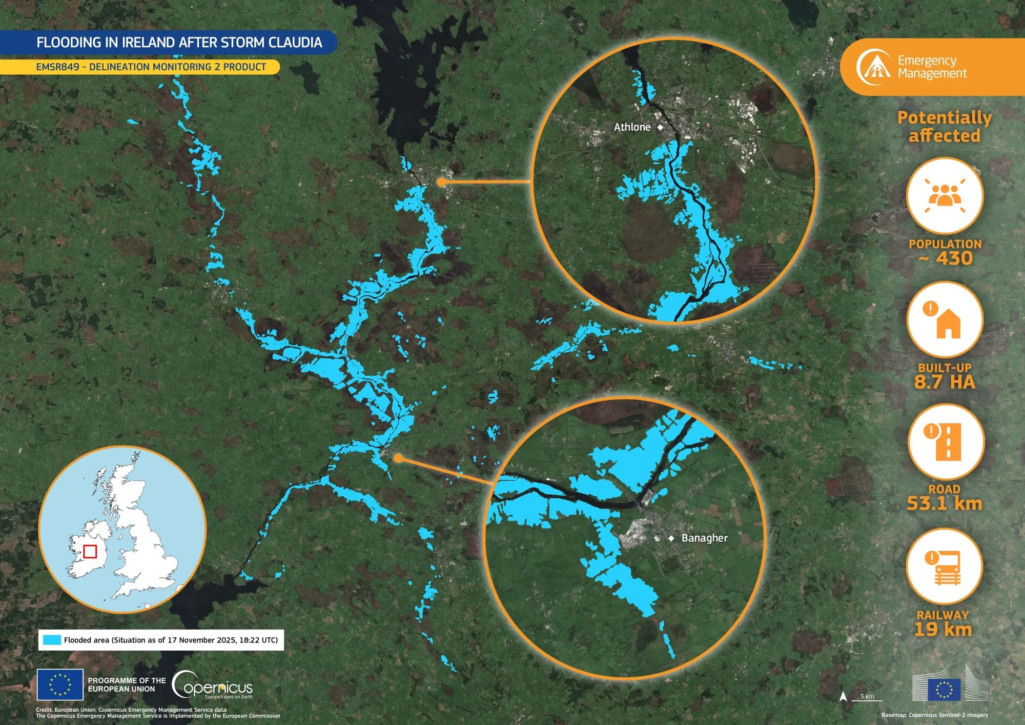
Radar and rapid mapping show flood extent and what is affected within hours.
EMSR849: 53.1 km of road potentially affected.
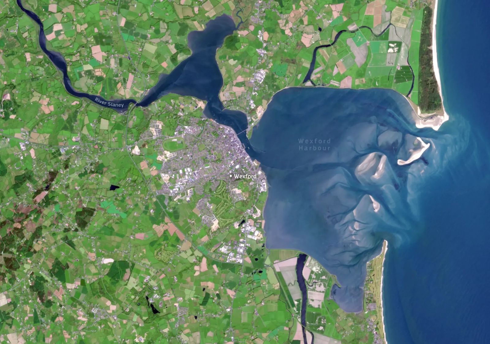
The River Slaney opens into a wide, shallow harbour where tides move sand and silt into shifting banks. Sentinel-2 records these sediment patterns, the Raven Point dunes and the reclaimed North and South Slobs in one view, a baseline for coastal change and water-quality work.
Irish relevance: continuity for sea-surface temperature and ocean-colour data around Irish waters.
Irish relevance: an AI assistant for EO data discovery, useful for new Irish users.
Irish relevance: look back at past Irish storms and heatwaves using ERA5.
ESA, EU Horizon Europe, EUSPA, Enterprise Ireland and Research Ireland opportunities for Irish EO work, sorted by closing date.
Browse opportunitiesVacancies at ESA, EUMETSAT, ECMWF and EU agencies, and in Irish universities, agencies and companies.
See EO jobsGovernment agencies, companies and research centres that use or provide EO in Ireland, from the EPA and Teagasc to Treemetrics and TechWorks Marine.
Open the directoryThe EU Space Networks bring together organisations across Europe that promote the EU Space Programme: Copernicus, Galileo, EGNOS and IRIS². Maynooth University is listed as a Copernicus Ambassador. EODataHub, run by the National Centre for Geocomputation, is how that role reaches Irish users.
The EODataHub continues the work of Ireland’s Copernicus Academy and Relay node, now merged into the single Ambassador role.
Promote Copernicus to Irish government, industry and the public, and show what it can do here.
Bring Copernicus data into teaching and research, and point people to Irish EO courses and training.
Help Irish users find and use the right Copernicus data, services and tools.
Connect Irish EO users and providers, and feed their needs back into the programme.