OBSERVER: How the EU Space Programme supports Search and Rescue – Galileo SAR Meet 2025
OBSERVER: How the EU Space Programme supports Search and Rescue – Galileo SAR Meet 2025
sonia
Thu, 14/08/2025 – 12:04
From Europe’s highest mountain ranges to the open sea, the EU Space Programme is helping rescuers save lives. Galileo’s Search and Rescue (SAR) service, the European Union’s contribution to the global Cospas-Sarsat network, provides rapid detection and precise location of distress beacons, while Copernicus provides free and open data which can be used to assist SAR mission planning. Every two years, the Galileo SAR Meet brings together crews from across Europe and beyond to test their skills, share experience, and help shape the future of this life-saving service. In this Observer, we look at how the EU Space Programme supports SAR efforts on the ground, with a spotlight on Galileo SAR Meet 2025.
Whether at sea, in the mountains, or in remote wilderness, locating people in distress has always been a race against time. The Cospas-Sarsat system, established in the 1980s, revolutionised this effort by enabling emergency beacons to transmit a signal to satellites, triggering a rescue response.
Today, the EU Space Programme plays a central role in this global safety net, which helps save 2,000 lives each year. Galileo’s SAR service delivers unprecedented speed and precision in beacon detection, and Copernicus supports search and rescue by making data available which can be used to assist mission planning, including forecasts of ocean currents and waves.
Together these capabilities show how Europe’s investment in space technology directly supports public safety and crisis response.
Galileo SAR in the global search and rescue system
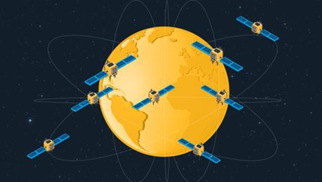
Galileo operates in Medium Earth Orbit (MEO), and as of mid-2025 the constellation includes 27 operational satellites. Thanks to a combination of its MEO configuration, advanced signal design, highly stable atomic clocks, and a robust global ground segment, Galileo provides around 1 metre accuracy, notably better than GPS, and its High Accuracy Service (HAS) can achieve decimetre-level precision (about 20 cm horizontally and 40 cm vertically).
Galileo SAR is Europe’s contribution to the international Cospas-Sarsat system, a global network designed to detect distress beacon signals anywhere on Earth and relay them to ground stations. Once a beacon is activated, its signal travels tens of thousands of kilometres to a satellite in orbit and back to the Galileo Ground Segment, where the location is calculated and sent to the nearest Rescue Coordination Centre. Cospas-Sarsat has participating satellites which operate in three distinct orbital segments: the original Low Earth Orbit (LEOSAR) and geostationary (GEOSAR) segments, and the more recent Medium Earth Orbit (MEOSAR) segment.
The addition of MEOSAR to the Cospas-Sarsat system marked a major improvement in coverage and responsiveness. Whereas LEOSAR and GEOSAR could take up to four hours to detect a beacon and typically provided a location uncertain by around ten kilometres, MEOSAR enables near-real-time detection, less than ten minutes in all cases, typically just two or three minutes, and positioning accurate to under two kilometres, often closer to 600 metres. With 27 operational satellites carrying a search and rescue payload, Galileo represents the largest single contribution to the Cospas-Sarsat MEOSAR segment, ahead of other participating constellations.

Galileo is also the only Global Navigation Satellite System (GNSS) to provide a Return Link Service (RLS). Once a beacon’s position has been determined, the system sends an acknowledgement back to the beacon, reassuring the user that their position has been computed and that rescue services have been alerted. Although RLS does not change the immediate situation of the person in need of rescue, it can provide a significant morale boost. They may still be lost in the mountains or adrift at sea but knowing that their location is known and that rescue services have been alerted can, in many situations, make a critical difference.
Galileo SAR Meet 2025
The Galileo SAR Meet, first held in 2021, brings together Search and Rescue units from across Europe and beyond for a combined skills competition and professional forum. The 2025 edition, hosted by the Czech Air Force in the Czech Republic, followed tradition by being organised by the previous winning squadron, with the European Commission providing financial and organisational support alongside EUSPA.
The event has two main parts: the SAR contest and the symposium. The contest is a chance for each squadron to showcase the skills, assets, and teamwork which underpin mission success. The contest is structured in three categories: the flying challenge, rescue challenge, and the ground crew challenge. In the flying challenge, crews are tested on navigation efficiency as helicopters race between waypoints under simulated operational pressure, along with precision hoist operations. Crew resource management, cooperation, and the ability to adapt on the fly are essential to completing tasks during the navigation competition. The rescue challenge focuses on hovering precision and crew coordination, with tasks such as moving a water-filled bucket between high platforms while minimising spillage (the bucket of water was replaced by a dead weight this year due to strong winds in Prague) or precision landing exercises where helicopters had to land as close as possible to a marked point to simulate landings in difficult terrain such as narrow mountain ridges. New in 2025 was the ground crew challenge, which gave ground maintenance crews timed tasks to complete while their pilots competed in the air, underscoring the importance of ground teams in mission success. The Niederstetten German team, flying an Airbus EC145 helicopter, took the top spot in the 2025 edition, winning across the flying, rescue, and ground crew challenges.

The symposium side of the event, hosted and co-organised by EUSPA, featured lectures and exchanges between participating squadrons and invited guests. The Spanish team shared experience from operating in high-altitude, hot-weather mountains, while the Norwegian contingent discussed mobile-phone detection in SAR missions. SAR experts from British Columbia Search and Rescue compared Canadian and European practices, noting that Galileo signals often support their operations without crews even realising it.
A live demonstration of beacon activation illustrated the speed of the Galileo SAR service, with return link confirmation reaching the beacon within minutes.

Listening to the users
While the challenges and lectures make for a compelling event, the SAR Meet has a deeper purpose. It is one of the few opportunities for Galileo engineers and managers to meet hundreds of SAR professionals face-to-face, hear about their operational realities, and gather requirements for future improvements.
Needs vary widely across geographies. The challenges of finding a missing hiker in Portugal are very different from rescuing sailors from a capsized vessel in Arctic waters or locating climbers stranded in the Alps. The experience of SAR crews in diverse and often extreme conditions provides valuable insights which can be used to make the service more effective in the field.
Some of the most promising ideas under development include two-way communication allowing coordinators to send pre-set questions and receive coded answers in the beacon’s display language, and remote beacon activation, enabling authorities to trigger a beacon if someone is missing and unable to signal.

Copernicus Marine data supporting SAR at sea
While Galileo provides the rapid detection and precise location of distress beacons, Copernicus also contributes to the wider picture of search and rescue. The Copernicus Marine Service (CMEMS), for example, provides free and open near real-time data on ocean conditions, including information on currents and waves, which rescue coordinators and service providers can feed into drift models and decision-support tools to narrow down search areas, plan routes and timings, and reduce risk to crews for rescue operations at sea.
One such use case is the OCEAN-SAR Search and Rescue decision support system, developed by LINKS SPA and the CMCC Foundation. Using CMEMS Mediterranean physics and wave forecasts, it simulates how a person or object in the water is likely to drift over time. By entering the last known position, rescue coordinators can visualise the most probable search area and the mean trajectory, enabling faster, safer, and more targeted operations. While SAR centres already have similar tools at their disposal which rely on maritime data sources such as buoys, this is an interesting example of how free and open Copernicus products and data can also be used to support search and rescue efforts.

Looking ahead
As Galileo continues to improve the speed and precision of rescues, Copernicus adds the wider environmental context with free and open data and products, such as currents and wave forecasts, which can potentially be used to feed drift models and decision-support tools for search planning. Though the automated integration of Copernicus data into SAR coordination does not exist in practice, the openness and availability of Copernicus data makes such a synergy an intriguing possibility for the future.
Looking ahead, the EU Space Programme will continue to work with the people who rely on its services, ensuring that innovation is guided by the real-world needs of users. From the moment a distress signal is received to the arrival of rescue crews, space-based services play an important role in guiding responders and saving lives.

Thu, 14/08/2025 – 12:00